
A Virtual Tour of Long Island Sound Habitats

This resource has been reviewed by SubjectToClimate's climate scientists and verified for scientific accuracy and up-to-date information. Learn about our review process →
Provided by: Long Island Sound Study|Published on: April 5, 2024
Lesson PlansScientist Reviewed
45678
Scientist Reviewed This resource has been reviewed by SubjectToClimate's climate scientists and verified for scientific accuracy and up-to-date information. Learn about our review process →
Synopsis
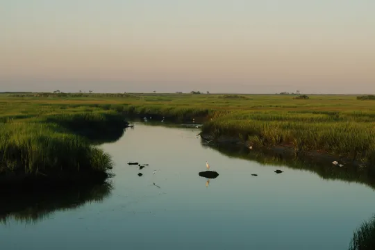
- This interactive resource provides a virtual tour of seven types of habitats in the Long Island Sound using text, maps, photos, and videos.
- The habitats covered are coastal grasslands, salt marshes, beaches, rocky intertidal, tidal flats, submerged aquatic vegetation, and open water.
- For each habitat, students learn what it is, the benefits it provides, what animals and plants live there, threats to this habitat, including climate change and invasive species, and what we can do about those threats.
- Connecticut locations mentioned in this resource are Waterford, Madison, Stonington, Niantic, Branford, Stratford, Westport, Groton, and West Haven and New York locations mentioned are Rye, Lloyd Harbor, Caumsett State Historic Park Preserve, Sunken Meadow State Park, Old Field, Bronx, Stony Brook, Brookhaven, Riverhead, East Marion, Orient, Suffolk County, and Fishers Island.
Subjects: Biology, Earth and Space Sciences, Geography
Authors: Long Island Sound Study, NY / CT Sea Grant
Region: Connecticut, New York, Long Island NY
Languages: English
Teaching Materials
Positives
- The resource provides a wealth of information in various formats to meet the needs of visual, verbal, auditory, and tactile learners.
- The student version of the StoryMap uses student-friendly language and bullet points.
- Students can easily navigate the StoryMap independently on their own devices, allowing them to work at their own pace.
Prerequisites
- There are two versions of the StoryMap, one for teachers and one for students. The teacher version provides more detailed text, aligned NGSS standards, and additional resource links, such as related lesson plans.
- Teachers should consider pre-teaching some of the unfamiliar glossary terms.
- There is a teacher webinar about this resource that can help with facilitation.
- The following links in the student version are broken: CT Grasslands in the Coastal Grassland section, Mud and Mudflat Basics, Mud Creatures, and Identifying Seashells in the Tidal Flats section and CT Beach Clean-ups, Volunteer Opportunities in LIS, Debris Tracker, and Horseshoe Crab Monitoring in the Conclusion section. These links are also all broken in the sources list.
- In addition to the list above, the following links are broken in the teacher version: Salt March Biodiversity Lesson Plans in the Salt Marsh section and Seagrass Lesson Plan in the Submerged Aquatic Vegetation section. These are also broken in the sources list.
Differentiation & Implementation
- There are two Google Docs that outline the accessibility features of this tool for people who are visually, reading, or hearing impaired.
- This resource is designed for middle school students, but teachers can modify it to use it in elementary or high school classrooms. The resource provides two Google Docs with NGSS standards that align with these age groups.
- Younger students may benefit from walking through the resource together as a class, while older students will enjoy exploring the resource independently and moving at their own pace.
- The provided glossary can benefit younger students and English language learners.
- Challenge students to find a way to get involved in conservation efforts for these habitats. The resource lists ideas and resources for this in the conclusion section.
- Social studies and geography classes can use this resource to learn about the types of geographical features in this region and how to read maps.
- Earth science teachers can use this resource to learn about geologic features, geologic processes like weathering and erosion, and the impact of climate change on geologic features.
- Teachers can use this resource in life science classes to learn about biodiversity, habitats, ecosystems, and invasive species.
- If time is limited, teachers can assign students to a section and have them report what they learn to a small group or present it to the class.
This resource from Long Island Sound Study introduces students to seven Long Island Sound watershed habitats. The student StoryMap page is an interactive resource filled with clear bulleted text, photos from Long Island Sound, and many videos that feature experts working on habitat restoration in New York and Connecticut. The resource highlights the impacts of climate change and the role that some habitats can have as a carbon sink. This resource is exceptionally well-sourced, cites all sources, including many peer-reviewed, and includes a helpful glossary of terms at the bottom of the StoryMap page. This resource is recommended for teaching.
Teaching Tips
Standards
Resource Type and Format
Scientist Reviewed
This resource has been reviewed by SubjectToClimate's climate scientists and verified for scientific accuracy and up-to-date information. Our review process ensures that every resource in our library reflects the current state of climate science.
Learn about our review process →