
Can Wisconsin Go Solar?

This resource has been reviewed by SubjectToClimate's climate scientists and verified for scientific accuracy and up-to-date information. Learn about our review process →
Provided by: Wisconsin Center for Environmental Education|Published on: July 13, 2023
Lesson PlansScientist Reviewed
6789101112
Scientist Reviewed This resource has been reviewed by SubjectToClimate's climate scientists and verified for scientific accuracy and up-to-date information. Learn about our review process →
Synopsis
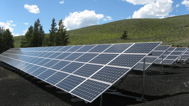
- This lesson leads students through an exploration into Wisconsin's potential for solar power production, including data analysis, ArcGIS maps, and a focus on solutions.
- Students will interpret solar dashboards, maps, and graphs to determine if Wisconsin is an ideal location for solar power.
Subjects: Geography, Engineering
Authors: K-12 Energy Education Program, Wisconsin Center for Environmental Education
Region: Wisconsin
Languages: English
Teaching Materials
Prerequisites:
- Ensure students know how to interpret graphs, maps, and charts. With younger students, consider going over how to read each map and graph as a class.
- Consider beginning with a primer on greenhouse gases, the greenhouse effect, and how current means of energy production are contributing to climate change.
- Consider defining the terms geospatial, generation, array, and photovoltaic prior to starting the lesson.
- Review latitude and longitude with students.
Differentiation:
- For students who do not speak/read English, translate the slides to their primary language using the translate function in Google Slides.
- Use strategic pairing if there are students who struggle with interpreting data. If many students struggle with this concept, the worksheet can be completed as a class.
Extensions:
- Students map out where solar panels are located in their area and/or discuss where the placement of solar panels would be in their area.
- Extend this exploration by having students research what their school would need to do to incorporate solar power if they don't already.
- Students learn more about solar using the solar dashboards with lessons from KEEP's Wisconsin Solar Schools Map and Dashboard.
This resource is a lesson plan developed by the Wisconsin K-12 Energy Education Progam (KEEP) that tasks students with determining if solar electricity generation is a good fit in Wisconsin. The included slide show features great instructions for students to give them confidence in navigating the linked ArcGIS resources and is filled with clear, well-sourced figures. The lesson also features a student sheet to help students organize their collected data into tables and includes space to answer questions. This resource really forces students to analyze how solar electricity generation varies seasonally and geographically and to think about how areas with low photovoltaic power potential can still successfully include solar electricity generation in their energy portfolio. This resource is recommended for teaching.
Teaching Tips
Standards
Resource Type and Format
Scientist Reviewed
This resource has been reviewed by SubjectToClimate's climate scientists and verified for scientific accuracy and up-to-date information. Our review process ensures that every resource in our library reflects the current state of climate science.
Learn about our review process →