
Hurricanes as Heat Engines

This resource has been reviewed by SubjectToClimate's climate scientists and verified for scientific accuracy and up-to-date information. Learn about our review process →
Provided by: My NASA Data|Published on: June 26, 2025
Lesson PlansScientist Reviewed
6789101112
Scientist Reviewed This resource has been reviewed by SubjectToClimate's climate scientists and verified for scientific accuracy and up-to-date information. Learn about our review process →
Synopsis
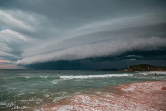
- In this interactive StoryMap from My NASA Data, students will use real data to analyze the impact of ocean temperatures on hurricane severity.
- Students will create and defend claims, analyze and interact with data, and use what they have learned to create hurricane forecasts by analyzing the beginnings of Hurricane Fabio.
Subjects: Physics, Earth and Space Sciences
Authors: My NASA Data
Region: Global
Languages: English
Teaching Materials
Positives
- The prompts and questions in this lesson do a great job of guiding students in the analysis of maps and other data.
- The many interactive components of this lesson help students remain engaged and improve their skills in using relevant data and tools.
Prerequisites
- Teachers should show students how to navigate the StoryMap lesson and guide students in using the Student Sheet.
- In the directions for Using the Earth System Data Explorer in Part 4, students are prompted to select "Line Plot" under the Analysis Tools section. This tool does not exist, and students should instead select "Time Plot" and follow the rest of the directions as written.
Differentiation & Implementation
- Teachers may want to change the question where students write their claim into a heading they can easily click back to from the table of contents or have them right on a sticky note to easily reference without losing their place.
- When making sense of the Power Distribution Index chart in Part 2, students may get lost in the explanation for the two different labels for the y-axis. Teachers may need to explain this verbally to students.
- For filling out their Student Sheet and interacting with links outside of the StoryMap, teachers may want to show students how to use split screen to reduce time spent toggling between tabs.
- After completing this lesson, teachers can connect this with the ocean warming that is happening due to climate change. How do students think this will impact hurricanes? If students are unfamiliar with warming oceans, this module can help explain this concept.
This resource from My NASA Data program provides an interactive Story Map to help students explore how hurricanes function as heat engines. It features visuals, guiding questions, and well-documented NASA datasets. While some links are broken and the data is several years old, it remains scientifically sound and suitable for classroom discussions on Earth systems and hurricane dynamics.
Teaching Tips
Standards
Resource Type and Format
About the Partner Provider

My NASA Data
NASA offers petabytes of global Earth science data collected from satellites, but accessing these data in a traditional (or virtual) science classroom can be tricky. Since 2004, My NASA Data has supported students and teachers of grades 3-12 in analyzing and interpreting NASA mission data.
Scientist Reviewed
This resource has been reviewed by SubjectToClimate's climate scientists and verified for scientific accuracy and up-to-date information. Our review process ensures that every resource in our library reflects the current state of climate science.
Learn about our review process →