
Polar Bear Tracker

This resource has been reviewed by SubjectToClimate's climate scientists and verified for scientific accuracy and up-to-date information. Learn about our review process →
Provided by: Polar Bears International|Published on: September 13, 2022
Data, Graphs, and MapsScientist Reviewed
345678
Scientist Reviewed This resource has been reviewed by SubjectToClimate's climate scientists and verified for scientific accuracy and up-to-date information. Learn about our review process →
Synopsis
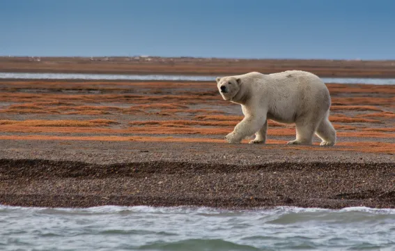
- This interactive resource allows students to track polar bears in Hudson Bay as they hunt on the winter ice and are sent back to land by melting summer ice.
- Students will learn about polar bears' patterns, the ice they use to hunt in winter, the research projects happening to help them, and how to get involved in polar bear conservation.
Subjects: Biology, Earth and Space Sciences, Geography
Authors: Polar Bears International
Region: North America, Polar Regions
Languages: English
Teaching Materials
Positives
- This resource is interactive and engaging for students.
- The included slides are incredibly informative and feature teacher notes for presenting to students.
Additional Prerequisites
- Students should have basic knowledge of polar bears and their habitat.
Differentiation
- This resource would work equally well in a science class thinking about habitats and patterns of movement or in a social studies class working on geography and mapping.
- For a long-term project, have small groups of students "adopt" a bear to track over several months. They can map the bear's movements, research additional polar bear information, calculate the distance traveled, and predict future movement based on ice.
- This resource can be used for a one-session lesson or over time to track the bears over a semester or year.
- Biology classes could use this interactive map to discuss how climate change is affecting plants and animals all over the world. Consider having students read this article or watch this video to extend the lesson.
This resource shows the migration pattern of polar bears and how they could be protected in their ecosystem. The technique used in tracking the bears is appropriate and this resource is recommended for teaching.
Teaching Tips
Standards
Resource Type and Format
About the Partner Provider

Polar Bears International
Polar Bears International is the only conservation organization solely dedicated to protecting wild polar bears. Through science, advocacy, media, and education, we work to ensure the polar bear’s long-term survival. Together, we can make sure that polar bears roam the sea ice for generations to come and improve conditions for people, too.
Scientist Reviewed
This resource has been reviewed by SubjectToClimate's climate scientists and verified for scientific accuracy and up-to-date information. Our review process ensures that every resource in our library reflects the current state of climate science.
Learn about our review process →